


Map shows offshore ambition
 Print
Print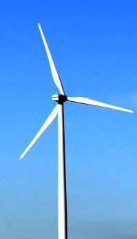 An interactive map is giving residents a look at proposed offshore wind turbines off Gippsland's Bass Coast.
Star of the South - the company behind the biggest offshore wind project in the Bass Strait - has released an interactive map showing how offshore wind turbines will look from areas including Woodside Beach, Reeves Beach, Port Albert and on the edge of the wind farm, from a boat.
The company wants to build a 2.2-gigawatt offshore wind farm located between 7 and 25 kilometres off the south coast of Gippsland, with a near 500-square kilometre patch to hold up to 200 turbines between Woodside Beach and Wilson's Promontory, connecting into the Latrobe Valley's power grid.
The Federal Government has granted an exploration licence to Star of the South to investigate the site, but it could take up to 10 years to develop.
Some residents living around the coast are already concerned about the visual impact on the iconic coastal landscape.
Latrobe University professor of psychology Bradley Jorgensen says the community needs to be brought onboard.
“It's really about trying to be a part of the change, rather than letting the change take you by surprise and run over the top of you,” he said.
“They have a vision of what this place is, and it's bounded in their experience of having lived there, they undertake activities in that region, they have social relationships, friends, family, in that region,” he told the ABC.
“They will be feeling left out in the sense that they have no control over what's happening in their place, they see it as being threatened by a viewpoint that they probably regarded as the out-group, as the enemy.”